Day 15, July 5
67 miles, Gettysburg, SD
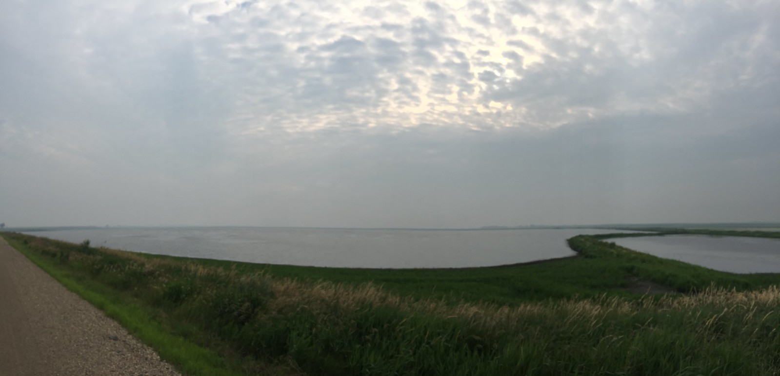
The day started off cool and clear and beautiful. We
followed the Missouri River north past the Corps of
Engineers dam and along Lake Oahe. The Missouri is the major
water source that divides the state of South Dakota in half
and it is a major influence on the state’s weather and
landscape. Just west of the River, the landscape becomes
arid and pine forested. On the east side where we are
traveling, we see green fields of wheat and corn albeit in a
contour that mimics the west side though covered in green.
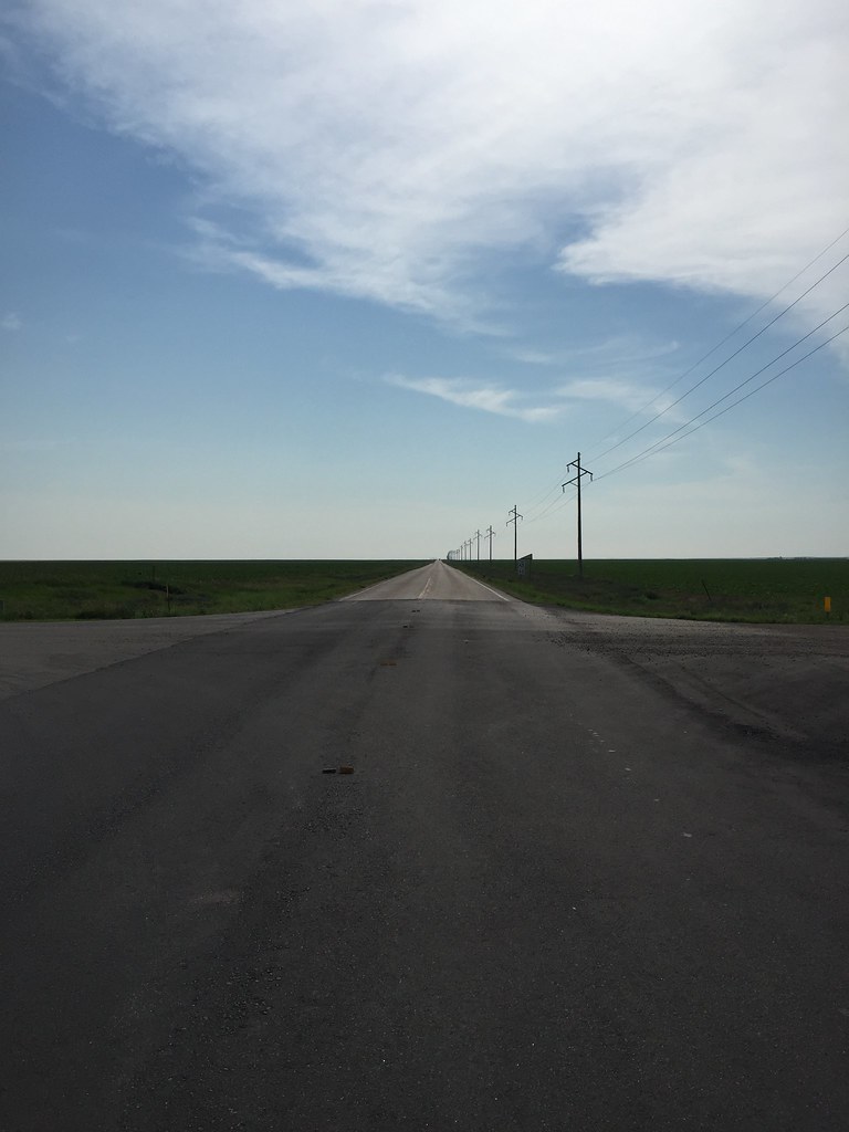
Once again I am thoroughly impressed with the incredible
distances that we can see. Farms seem to be 20 miles set
back from the road and we have not been in the shade of a
tree all day. This is a space I would not want to be caught
in a storm. I am constantly watching the weather and the
sky. Weather is part of all decision making processes here.
I monitor the radar too. Evenings can be cool and this is
what makes for our early rise and traveling. It seems as
though the winds can kick up later after the heat of the day
sets in. We are always on the look out for afternoon and
early evening thunderstorms. I am not afraid of getting wet
but I am watchful for lightening and high winds. I
don’t want to be caught on the prairie in 60 mph winds
and hail.
On the remote route today, we happen to come across a man from Scotland traveling in the opposite direction. There was something that seemed time honored about our talk in the middle of nowhere and we both shared stories for 5 or 10 minutes, and then parted ways. As the day more on, the winds shifted and we made our way to Gettysburg and was greeted with a sign saying this was not where the battle occurred.
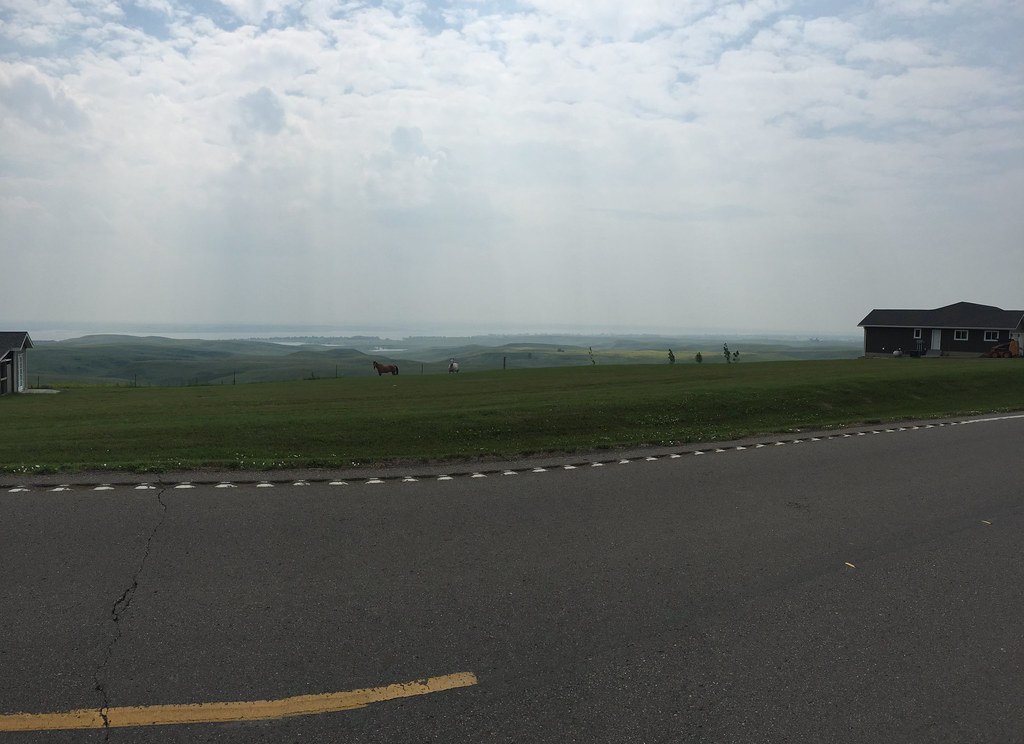
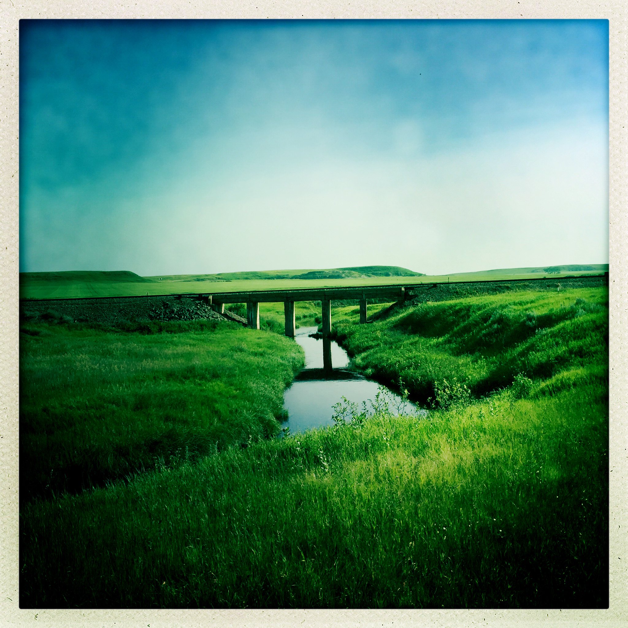
Day 16, July 6
60 miles, Mobridge, SD
A very cool start again. We are blessed with cool overcast
mornings. The only difficulty is the 20 mph headwind. We are
making 8-9mph but making progress. This morning we are
traveling through the glacial lake district of South Dakota.
There are wetlands and marshes everywhere. We see waterbirds
and pelican. This area defies my expectation because of all
the water. West of the Missouri it is like a desert, here it
is moist and green. The landscape is completely flat and
then gentle rolling and gaining in elevation. We must be
about 1500 to 2000 feet above sea level. A red tail hawk
follows us and then sits on a fence post and flies to the
next one waiting for us to get there and then flies to the
next one and keeps repeating this. The hills keep rolling
and gain in elevation more the closer we get to the
Missouri. We go through a small town with a population of
53. This feels more and more western as we travel and the
rural towns are very isolated. Hunting and fishing is the
main occupation and there is plenty of space to do that. We
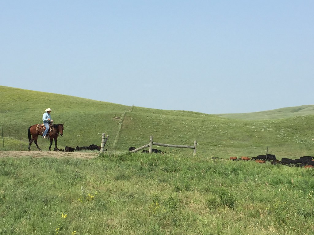
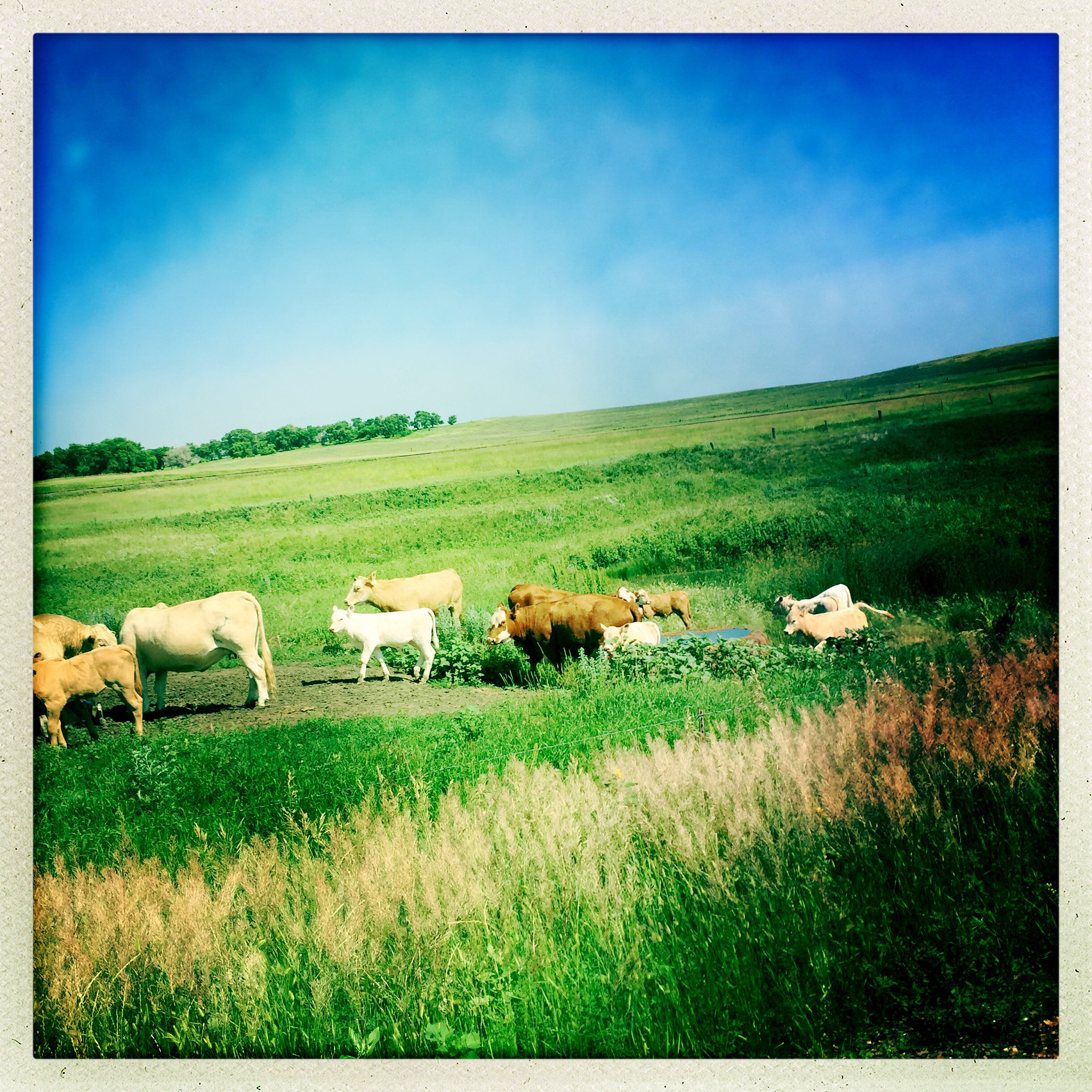
watched some ranchers herd their cattle into a lower pasture
using ATV vehicles. Later, I met one of them down the road
and we talked briefly. One of his cows had a hoove problem.
He had to go to the vet he told me. We rode off in another
direction after our brief chat. It seems as though
everywhere its a small town atmosphere and people will stop
and talk and be quite neighborly. We run into another person
who checked up on us to see if we had enough water.People
are generally very nice and we seem to share a strange
frontier mentality being out on the road on bicycles. This
landscape has a way of growing on me, though I am not quite
used to being so vigilant with the weather observations.
These open areas require a commitment to pay attention to
forecasts as winds can whip up to dangerous speeds and no
tree breaks to slow things down. Tonight we make camp not
far from the Missouri River.
Day 17, July 7
68 miles Beaver Creek, ND
It was quite chilly this morning. We got up to eat breakfast
and had to bundle up. Leaving about an hour later than
usual, we had tail winds and good weather all day. The
elevation went up and down all day. We followed the Missouri
River most of the day and saw incredible views and long
steep down hill runs. It is difficult to photograph or
capture the perspective,- the views look cartoon like as the
road ribbons around the landscape and then drops off
suddenly. Sometimes it is straight as an arrow and blurs out
in the distance that makes it look like it is a painted back
drop. The countryside is open and exposed and is no place to
spend the night. We meet another cyclist today from Seattle
going the opposite direction. Shortly after, there is a
cattle traffic jam on the road and we have to wait for the
ranchers to move several hundred cows off the road. About
10miles further we run into another group of cowboys herding
the cattle from the high pasture and the noise is almost
deafening. As we leave this section of ranch country, we
follow the Missouri north into North Dakota. After we cross
this border, the next corral contains about 100 buffalo and
they quickly jump up and move quickly to the back of the pen
when they hear us. All of the cattle and ranch sounds
quickly give way to silence as we slowly make our way to
tonight’s destination. Beaver Creek is border on
either side by a large expanse of water from Lake Oahe. Not
far from water’s edge is where we set up our tents.
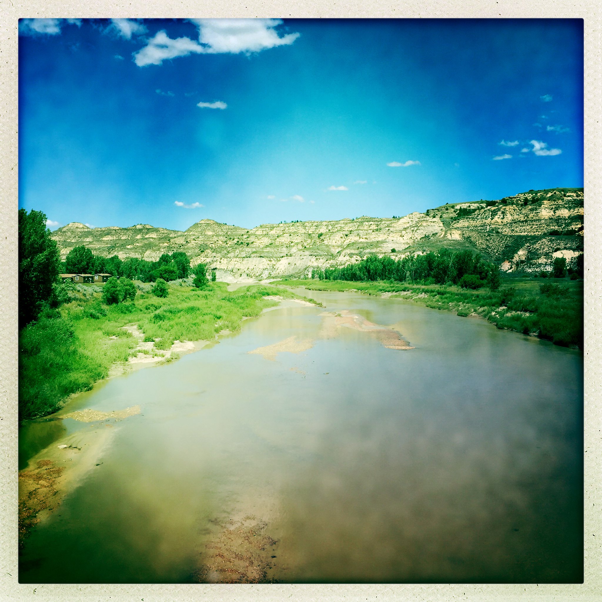
Day 18, July 8
51miles Bismarck, ND
After we break camp and move north, we follow the Missouri
River once again. The cool overcast morning makes for
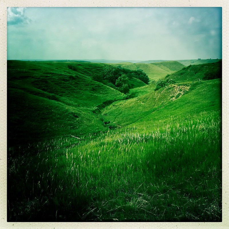
perfect travel. The buttes that we encounter look like a
green version of a Lunar landscape. The southwest corner of
North Dakota looks like what I would imagine the Central
Asian Step to look like. The other worldly hills look like
they have been dropped onto the Earth. Sometimes, what
appears to be a sand formation from the Badlands,-
unexpectedly rises from a green pasture. The rolling hills
take on an appearance of an underwater Ocean floor. Cattle
dot the rolling fields and the expanse is starting to fill
up with pine trees as we move further north. This area
defies my expectations as we get closer to Bismarck.
Farmland and small forests punctuate the countryside,- I
could mistake this for Wisconsin or upper peninsula
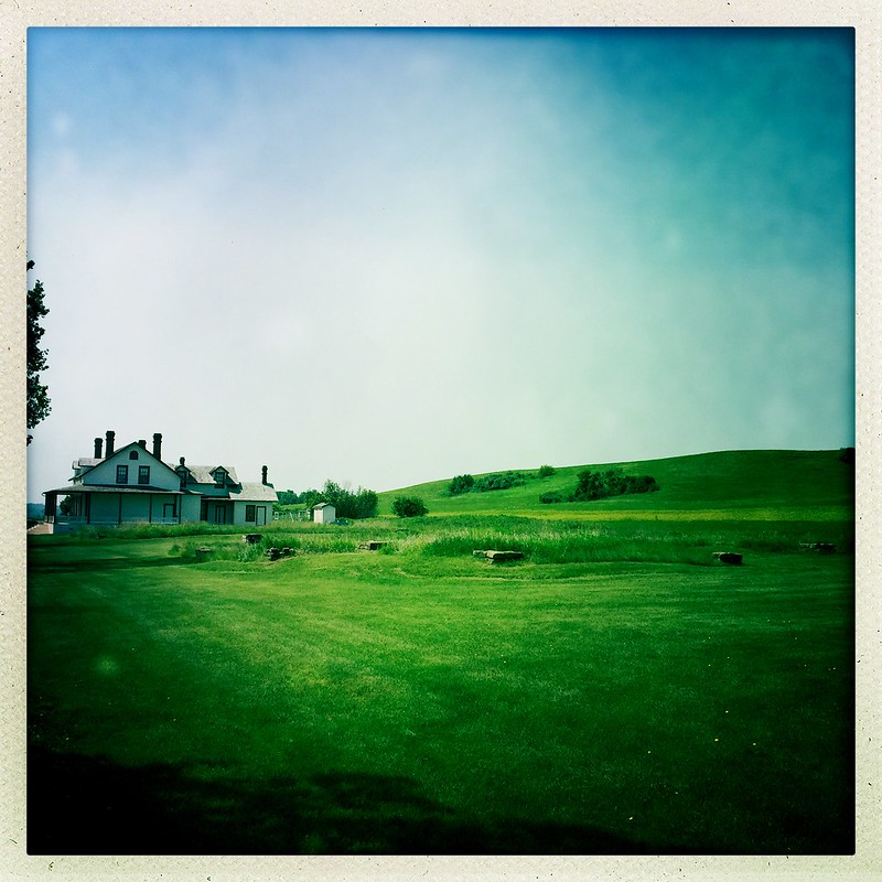
Michigan. Tomorrow, we will stop at ft. Abraham Lincoln. The
first post commander was Lt. Colonel George A. Custer.
Day 19, July 9
41miles New Salem, ND
We leave Bismarck later in order to stop at Ft. Abraham
Lincoln. The fort was established to secure the northern
plains and subdue the Sioux and other bands not on
reservations after the 1868 treaty of Ft. Laramie. Indian
land was being encroached on after gold was discovered in
the Black Hills and as a result wagon trains were being
attacked. This threat to US expansion was seen as hostile
though the land secured for the Lakotas was constantly being
overrun illegally by settlers and miners. In 1876, three
columns of US cavalry was dispatched to round up Natives
deemed hostile, General George Crook from Ft. Fetterman in
Wyoming Territory, General John Gibbon from Ft. Ellis in
Montana Territory, and the ill fated, Colonel George Custer
from Ft. Lincoln in Dakota Territory.
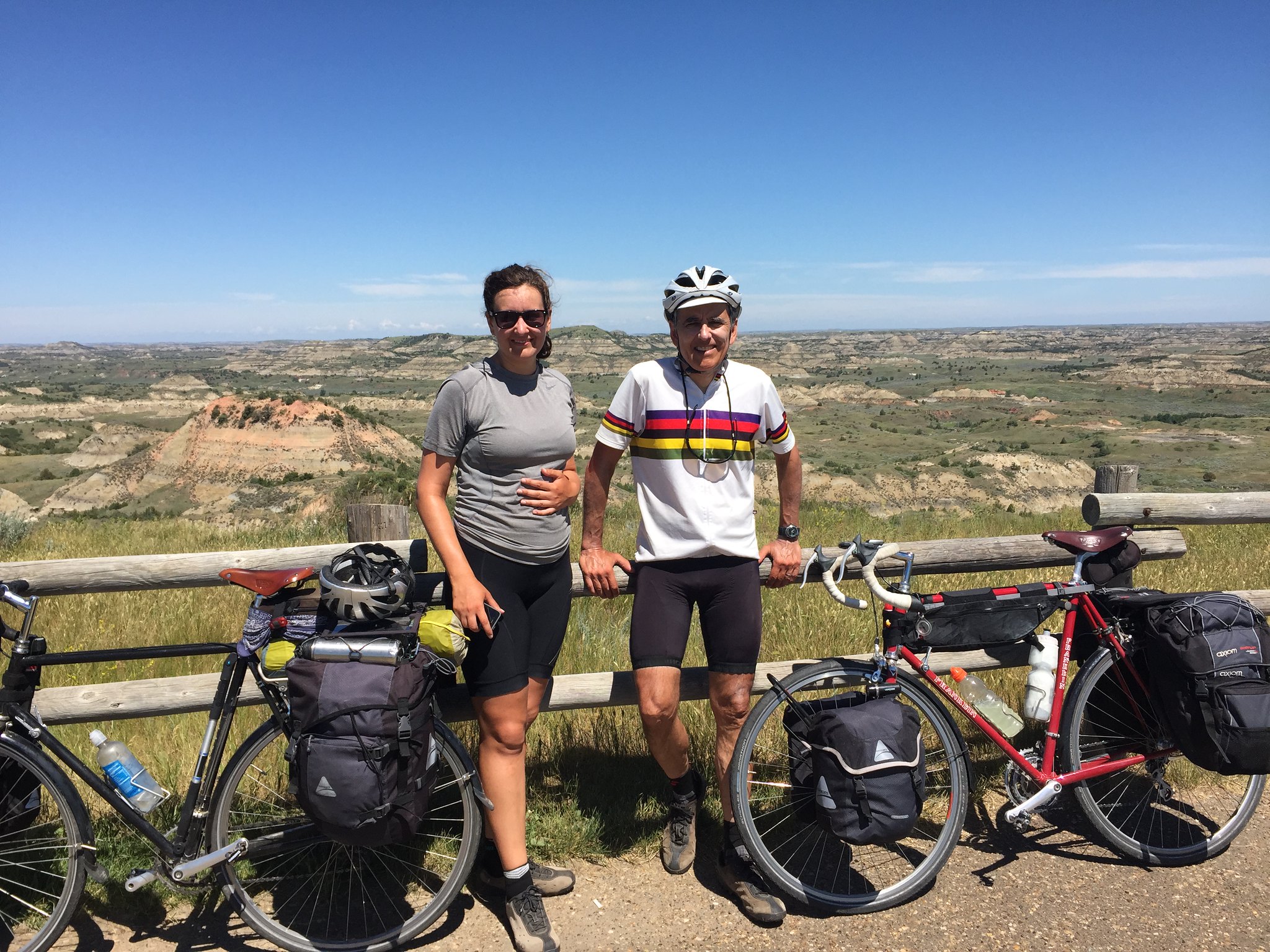
This is a the command house at Ft. Abraham Lincoln for Lt. Colonel George Custer. We set a survey marker not far from here. We rode west of Ft. Lincoln today along a route that parallels Custer’s march to the Bighorn Mountains to subdue the Sioux. (He was one part of a three pronged assault that also included Generals Gibbon and Crook.) When we cross into Montana at Glendive we will also be following Custer’s path down the Yellowstone, the Powder, and the Little Bighorn Rivers. This is where Crazy Horse repelled Crook prior to sealing Custer’s fate at the last stand Battlefield adjacent to the Crow Reservation. Crazy Horse, Gall, and Sitting Bull defeated the U.S. Army three consecutive times before being subdued.
Day 20, July 10
75miles, Dickinson, ND
Moving west towards the Yellowstone River, we enjoyed a tail
wind all day which made for a quick and pleasant ride. This
direction we ride follows the path of Custer’s
campaign west in the 19th century to subdue hostile non
reservation Sioux, Arapaho, and Cheyenne and is also the
route (in reverse) where Lewis and Clark returned from their
journey to the west coast. When the Corps of Discovery came
through the area in 1804, the Sioux did not great therm with
as much enthusiasm as some of the other tribes. And rightly
so, because their hospitality would be met with constant
warfare and encroachment within just a few years of the
first contact. In only a handful of years, settlers began
pouring into the region and moving onto Indian treaty lands.
What Lewis and Clark didn’t realize was that the Sioux
had been all the way in Albany, New York in the previous
century talking to the British. Knowing that France and
England were the world powers at the time, the Lakotas were
perfectly capable of handling negotiations and trade on the
upper high plains and didn’t need a middleman to
broker their affaires. Being suspicious of the new comers
intentions, the Lakota Sioux correctly foresaw the
aggressive movement onto their territory. From an American
pioneer perspective, the upper Missouri was a vast and empty
plain, to the Native American, it was landscape that was
starting to get too crowded with ill intentioned newcomers.
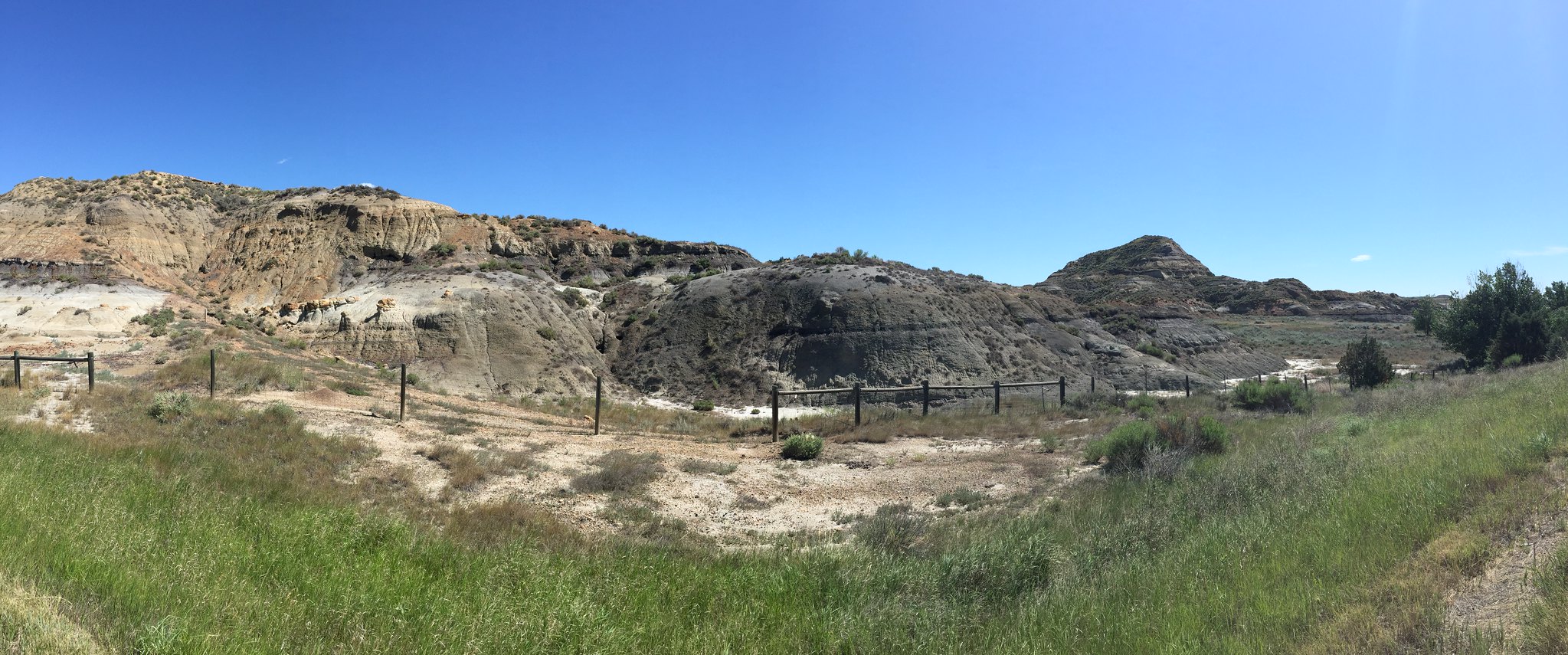
Day 21, July 11
63miles, Beach, ND
We have been seeing signs all day that this is
Custer’s trail. Moving west into a 20mph headwind made
for a challenging day. The landscape however was beautiful
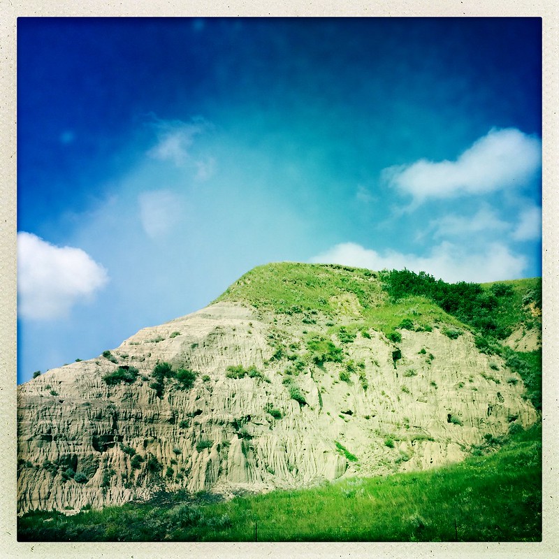
and extreme. In the morning, we see signs of the Badlands
type landscape formations in the distance. The little knolls
and buttes rise up in what looks like a lunar topology
although everything is covered in green. Occasionally, the
sides of one of these rises erodes away and reveals a dry
sandy soil that is typical of the Badlands formations. The
temperature rose to 91 today and the sky was clear and
seemed more typical of the dry west than the moist storm
riddled Dakotas of the east. I don’t know which makes
travel more difficult because each has its challenges. Later
in the day we cross into Theodore Roosevelt National Park
and the Badlands seem to pop out full blown. We see a herd
of buffalo on ledges to the south of us as we go through the
park. The bison are free to roam the area and we cross huge
cattle grates to enter into the preserve. This landscape
today demands a different respect as the arid climate takes
it’s toll on our endurance. Rain fall drops off
dramatically in these areas compared to the midwest.
Tonight, we stay only two miles from the Montana border. As
we have traveled west the borders between states seem so
arbitrary and it puts us in a strange relationship to a
nineteenth century perspective. It is easy to see how this
land was seen as empty when the first Europeans arrived.
There is a quality of that that still overwhelms me with the
vast views and sparsely populated regions. I think Chicago
has more people than the whole state of South Dakota.
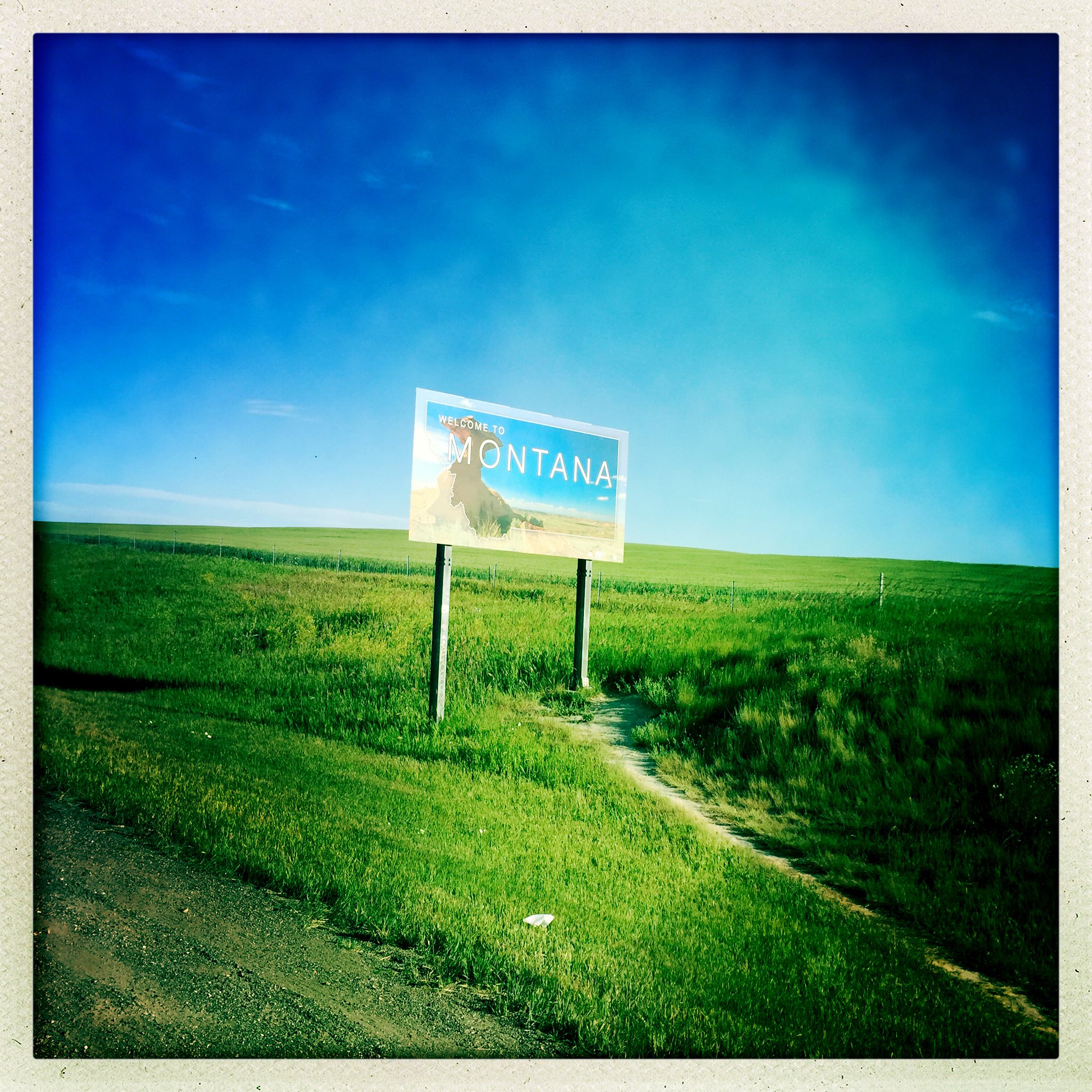
Day 22, July 12
36 miles, Glendive, MT
Today, we cross into Montana and are greeting with puffy
white clouds and a blue sky. Wind is a constant variable and
we are faced with gusts up to 20 mph. Though it can be
challenging, it starts to become a new medium to adjust to.
The landscape feels high in elevation though rolling in long
rises in it’s terrain and we see remnants of the
Badlands formations throughout the day. Time and distance
are directly related and influenced by wind. It might seem
like only 10 miles but a hurricane wind can turn that usual
short distance into a 3 hour event. As we meet other
cyclists, they mention waking up at 4 and leaving by 5am or
earlier to move. The frontier was and continues to be
influenced by weather and it dictates how to conduct our
daily travel. Normally, I would feel inconvenienced by
weather, but rarely would I alter my daily activities unless
it was an extreme event. Now, I am always aware of what the
sky is doing and how the fronts are changing. Being exposed
to the elements puts my body in direct relationship to my
surroundings. A hill or butte is something I don’t
just look at but I feel it in how much energy it would
extract from me or how much water it would take for me to
ride up its slope. As we travel through this arid region, I
find myself more and more monitoring my water consumption
and water bottles. Our day is shorter and tomorrow is a rest
day as we begin our 4th week.
Comments 10
Were you all able to speak to any folk of the Sioux nations? (Or from the reservations of S.D.)?
Did you at least stop for lunch/water in “Pollock” S.D.?
Author
Michael, I spoke with Kevin Locke, a Lakota from the Hunkpapa band of the Sioux Nation at Standing Rock, SD. He is working on the Lakota language project to ensure the preservation of Lakota as a spoken language. This is so critical to ensure the continuation of their culture and its values. Restorative justice is a concept that we are interested in and it is inspired from native practices. (A criminal offense was seen as a violation of person,- not a state offense. This idea inspired the concept of talking circles to bring perpetrator and victim together to work out a reasonable and responsible solution to conflict where both parties see the implication of their actions.)
In modern locations of violent trauma such as Rwanda, versions of these practices have been effective in promoting healing and this inspires hope!
Wow, what amazing photos! When you mentioned the herds of bison, I wonder if smelling them is similar to smelling the horses that are around Central Park NYC? So is 91 degrees out in the plains the same with humidity? More safe travels and smooth tidings!
Author
Linda! There are more cows in this country than you could ever believe and they look up and stare at you as you bike by. Every place smells different. It all feels VERY far from NYC
In your July 11 posting above you state, “There is a quality of that that still overwhelms me with the vast views and sparsely populated regions.” I’ll be watching for further commentary on this concept as you move along. I had these same feelings when recently visiting New Mexico. I am compelled to question people’s concepts of space and the sharing of it, both historically and currently, (as our U.S. population seems again to be clashing on this concept lately…) MJM
Author
Michael, It is so interesting how time and distance seem to change and stay the same. Our country seems so big and wide and spread apart. People are always amazed when I tell them I live in NY or that we traveled from Chicago. The United States is a huge place and I think as we divide our spaces into places and divide our time into activities we often get so focused on the immediate that we forget how to look up and out and wonder.
Hello Don and Julia;
I am in awe of the landscape and the vastness that still flows though our part of the continent. I have been reading about the building of the railroads. Have you witnessed any presence of old railroad work, tracks or continuous presence. How is modernity in terms of technology present in these areas?
Wonderful, wish I was there!
Author
Hi Jesus,
We often ride along railroads in so many states of use and disuse. I love riding by railroads because the railroads had to flatten the grade of the landscape, so bike paths next to rail lines are usually very flat! Sometimes some small towns have paved over rail lines and made them into bike paths.
Also, we entered many small towns, such as Ferdinand, Montana where the railroad is defunct and all that remains are the worn ties and old trestles. In some areas, other modes of transporting goods just became more cost effective and the old routes just fell by the wayside. However, in central South Dakota, we would encounter train lines transporting grain and coal. We assumed that the coal extraction was coming from Williston, North Dakota because of the fracking of the coal region. In that area of North Dakota traffic is intense and its next to impossible to find a campsite,- so in that area shipping by rail eases up the traffic jams that plague the region.
Hi again Don and Julia,
One more- Would this land have been considered free range land for cattle? As Michael mentioned New Mexico, it would be interesting to compare both passages to the west; northern and southern as they somehow appear similar in terms of landscape and openness.
I can help of thinking of Coronado or Cabeza de Vaca, the Spanish explorers as I see some pictures.
Thanks
Author
Where we were, it was difficult to tell if an area was government owned or private land. Everything we saw had a barb wire fence running through the landscape. When we looked into the history of say, the Lochsa River by Lolo Hot Springs, Montana, we discovered a checkerboard pattern of US owned and logging company owned land. This partitioning up of the land along with Homesteading and railroad ‘right of ways’ were basically how Indian land was divided up. Free range grazing is a contentious issue in the west as it is an arid land and more ground is needed for cattle grazing than in the eastern US. The ranchers out west feel that letting the cows roam on remote land uses resources that would otherwise go to waste and besides, who and how would one patrol this. It would seem like a waste of time and money to set up an agency to monitor what grass a cow ate. In the east, where it is more crowded, people think that any use of any land should be highly monitored and watched. Each conflicting side makes good points. The difficult thing to understand from an eastern point of view is the vastness of the landscape in the American west. I can see even today where the sense of North America as an empty place in need of development comes from as we travel for days through what seems like an endless a country grasslands and desert buttes.